Borzabadبرزآباد
Location: The site of Borzābād is located 48 km north of Arak, in central western Iran, Markazi Province.
34°32’13.5″N 49°40’06.0″E
Map
Historical Period
Achaemenid, Parthian, Islamic
History and description
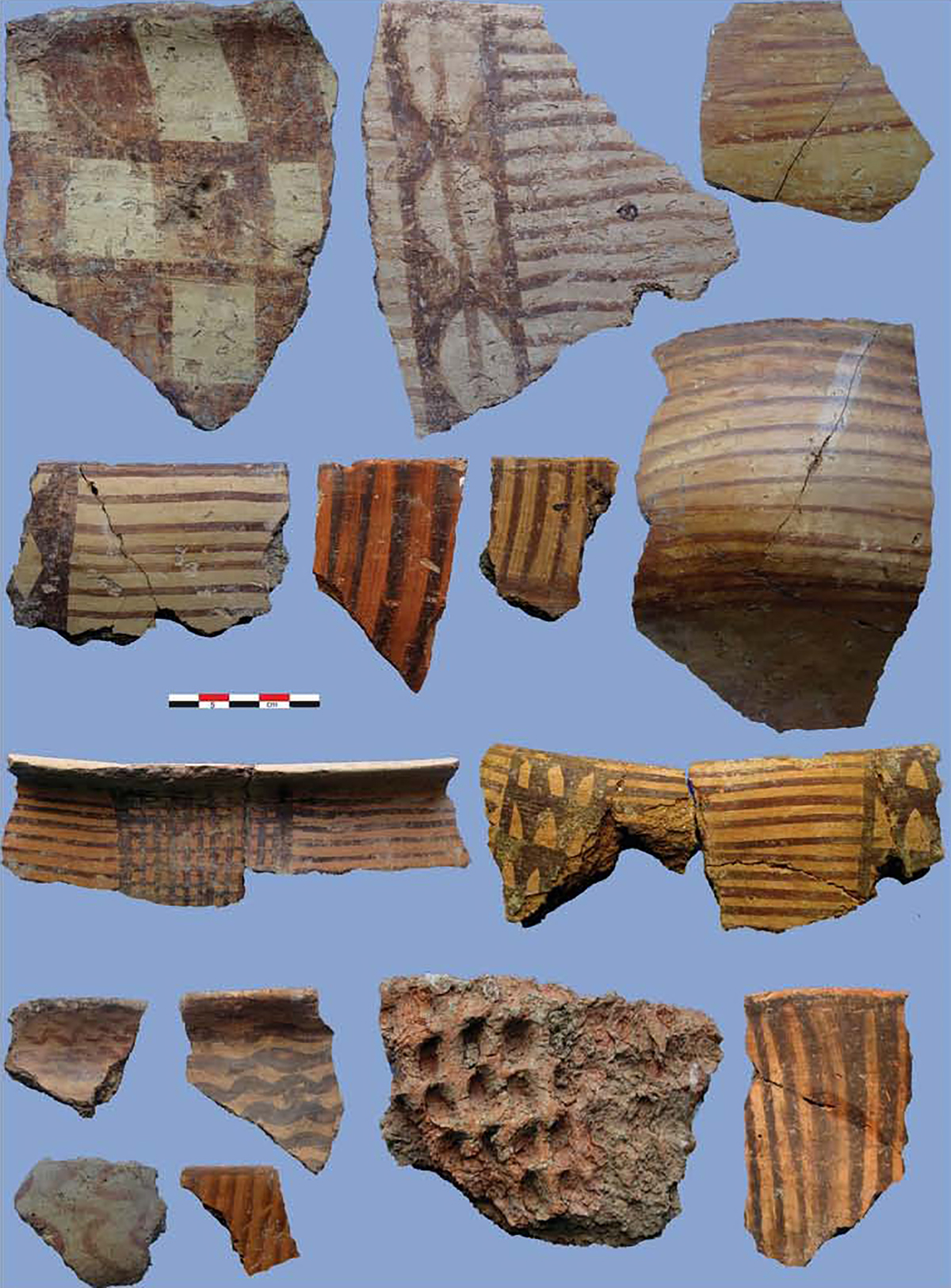
The small village of Borzābād lies on the west side of the Arak-Hamadan road. Hasan Qomi, the author of Tarikh-e Qom, mentions Borzābād as being a village with a lot of water to the point that it was known as Farābeh o Porābeh (Tarikh-e Qom, p. 65). There were two low mounds at Borzābād, Borzābād Tepe East, to the northeast of the village, and Borzābād Tepe West, west of the village. Today, there is barely any trace of the mounds. They both seem to have been destroyed in the course of farming activities. Borzābād Tepe East was an oval mound, 70/80 m in diameter with a height of about 3 m. Based on the surface pottery, the eastern mound had been occupied in the Achaemenid period as indicated by the presence of horizontal handle wares with dark-faced, small bowls, and jar rims. There were also examples of the thickened, inverted-rim bowl. The western tepe, with a diameter of 30 m and a height of 3 m, was in the middle of cultivated fields. The mound had its summit cut, revealing brickwork of certain Islamic dates. The surface pottery shows various Islamic wares but there were one or two Clinky ware sherds and one or two fine bowl rim profiles of Achaemenid period.
Archaeological Exploration
David Stronach and Cuyler Young visited the mounds at Borzābād in their archaeological survey of the central western Iran in 1965.
Stronach, D. and T. C. Young, The 1965 Archaeological Survey of Western Iran, unpublished manuscript, the David Stronach Archive, BIPS.