Riviریوی
Location: Rivi is a large archaeological site in northern northeastern Iran, Khorasan Shomali Province.
37°34’09.0″N 56°52’43.4″E
Map
Historical Period
Bronze Age, Iron Age, Achaemenid, Parthian, Sasanian
History and description
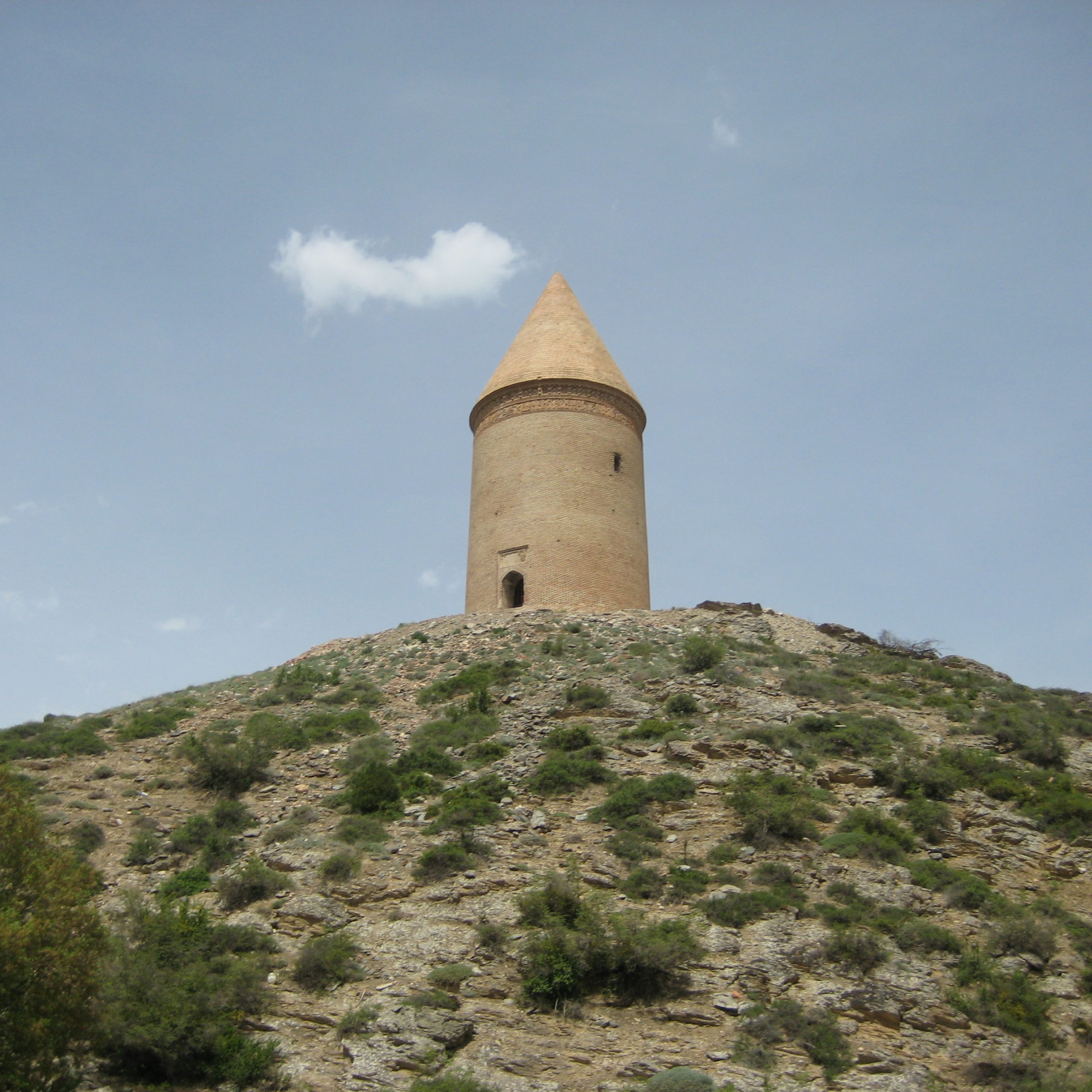
Rivi, located 50 km northwest of Bojnurd in northern Khorasan, lies within the intermountain river valley of the Samalghan Plain, between two mountain ranges in the northeastern confines of Khorasan. The Samalghan River runs near the ancient site and enters the Maneh Plain through the Darband corridor to flow into the Atrak River.
The site of Rivi was first discovered by Ezattolah Negahban, in his survey of the Khorasan region in 1963. Negahban refers to the mound as Ribba Tepe (Rūbāh Tappeh or Fox Hill) because of the numerous holes dug by clandestine diggers. In the local dialect, rivi means fox.
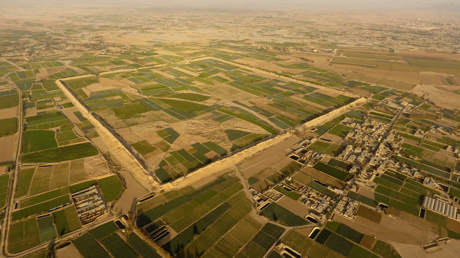
The site consists of four major mounds (fig. 1). Rivi A is located in the south of the site; it is 8 m high and covers 5818 square meters. Rivi B is located 600 m to the north; its height is 5 m and covers 3346 square meters. Between the two, lies the Rivi C mound 2 m high; it covers approximately 4000 square meters. The Rivi D mound is near tile and brick factories and has been reduced to a quarter of its original size. Aerial photographs show that there was a mound much larger than the surviving mounds mentioned above, which was entirely destroyed because of the construction of two brick-making factories in the 1980s (fig. 2). Farming and industrial activities in the past forty years largely transformed the topography of the ancient site. What has been left of the site is less than 70% of what Negahban saw in the early 1960s.
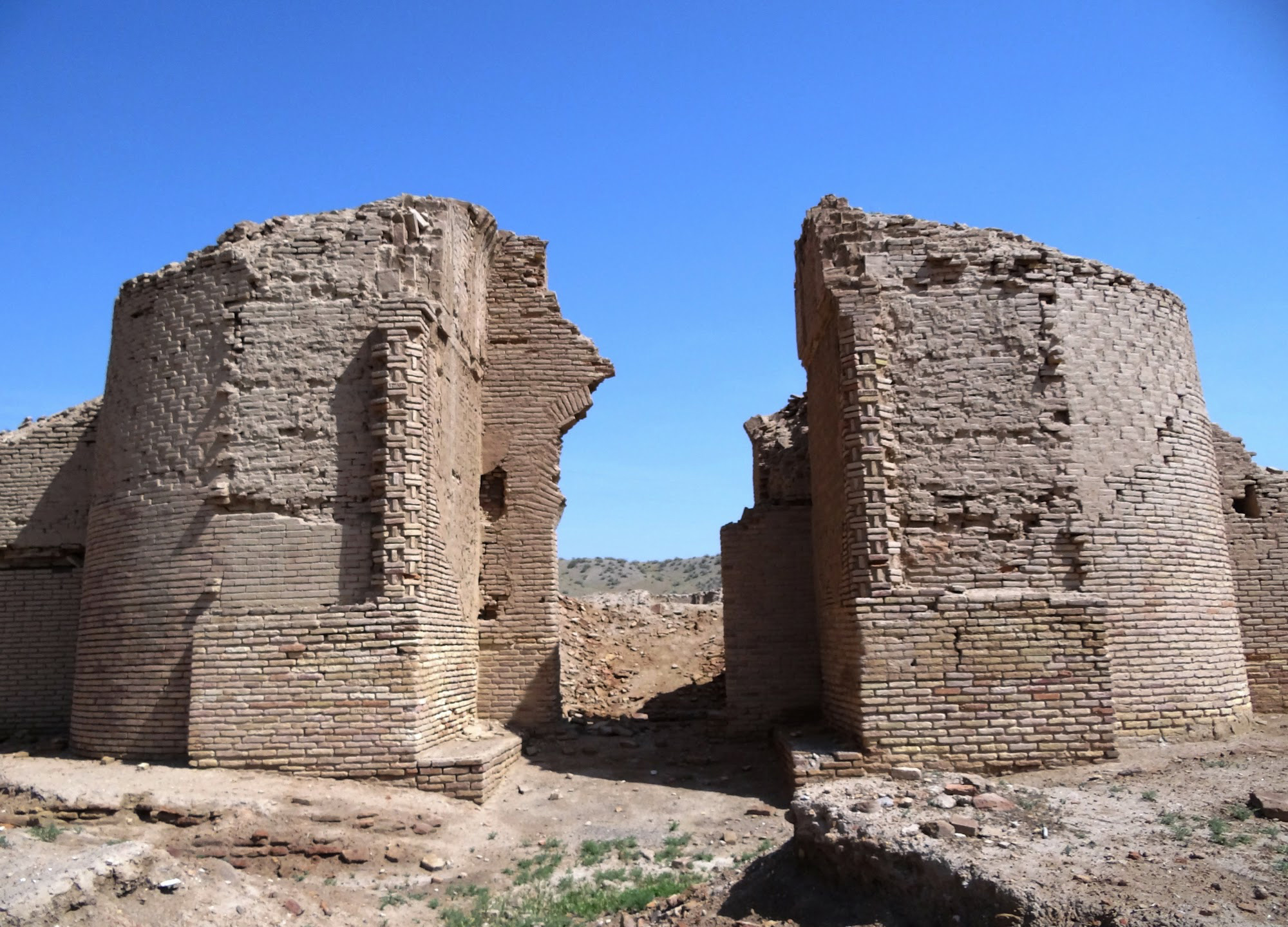
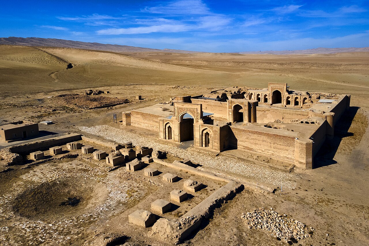
Excavations at Rivi A revealed architectural remains ranging from the Iron Age II period to Parthian times (fig. 3). Rivi B seems to contain remains of the Parthian and Sasanian periods. Soundings in the northern sector of the site resulted in the discovery of a Bronze Age graveyard; trenches in the eastern part of the site yielded remains of an early Islamic period settlement. Rivi has four archaeological periods: Period VI: a graveyard of the Bronze Age in the vicinity of Rivi B. Period V is mainly represented with the Iron Age II/III materials (mostly ceramics) with scant architectural vestiges such as mud-brick walls founded on a layer of gravel in Trench LM-18. Rivi Period IV has been dated to the Achaemenid period. Rivi III covers mostly the remains of the Parthian and Sasanian periods. Rivi Period II is defined based on potsherds of the Islamic period and the architectural remains of the presumed Islamic fortress. Rivi Period I is the most recent period of occupation, including seasonal nomadic activities at the site.

Fig. 1. Map of the archaeological site of Rivi (photo: J. Ja’fari)
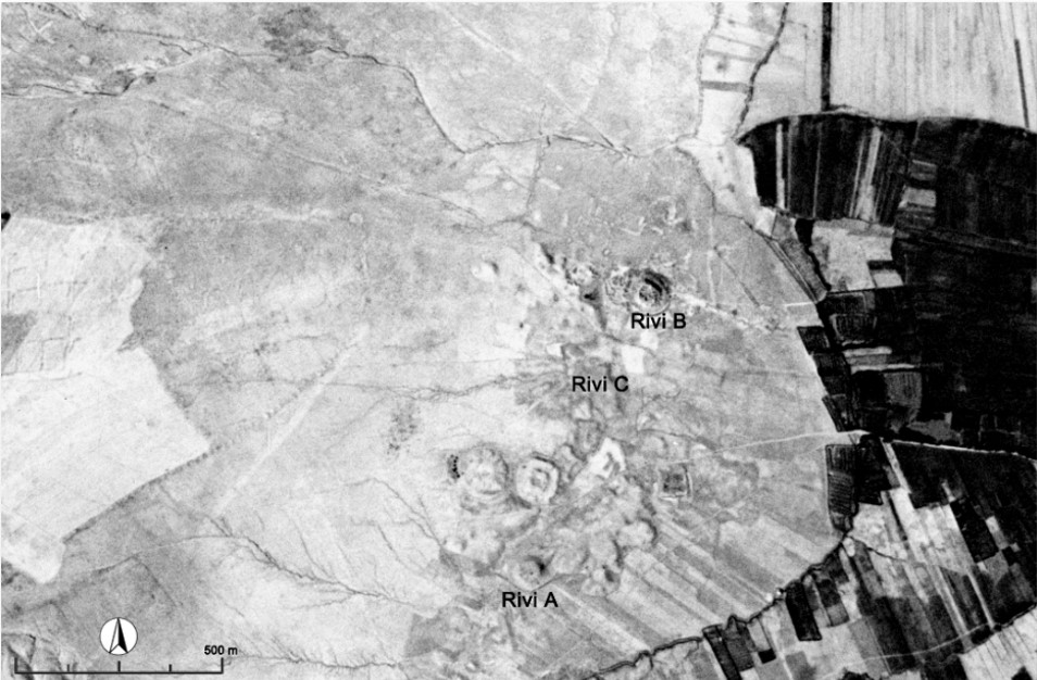
Fig. 2. A CORONA aerial photograph of the site of Rivi taken in 1969 (photo: J. Ja’fari)
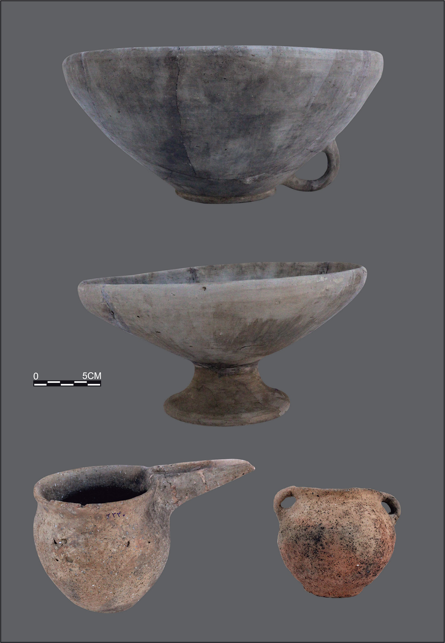
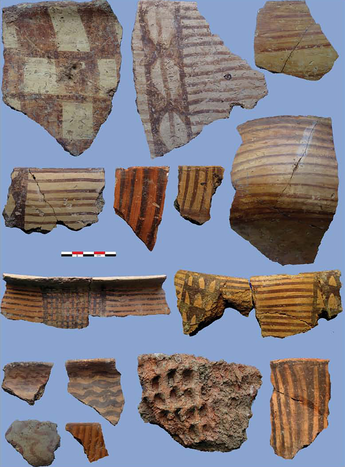
Fig. 3. Pottery vessels of the Iron Age period from Rivi (photo: J. Ja’fari)
Archaeological Exploration
Ezatollah Negahban discovered the site of Rivi in his survey of the Khorasan region in 1967. Later, Javad Jafari undertook the first systematic archaeological exploration of the site on behalf of the Iranian Center for Archaoelogical Research in 2012 and 2014. Then, the archaeological studies at Rivi became a joint German-Iranian project under the auspices of the Iranian Center for Archaeological Research and the German Archaeological Institute.
Bibliography
Jafari, J. and J. Tomalsky, “Report of the First Excavation Season ad Archaeological Studies at the site of Rivi, the Plain of Samalghān, Northern Khorasan,” Proceedings of the Young Archaeologists Conference, vol. 1, Tehran, pp. 423-472 (in Persian)
Jafari, J. and J. Thomalsky, “The Iranian-German Tappe Rivi Project (TRP), North-Khorasan: Report on the 2016 and 2017 fieldworks,” Archäologische Mitteilungen aus Iran und Turan, vol. 48, 2016, pp. 77-120.