Tepe Sornāتپه سورنا
Location: Situated in the Dasht-e Rostam plain, Tepe Sornā is 45 km northwest of Nūrbābād, southern Iran, Fars Province.
30°20’38.3″N 51°17’37.8″E
Map
Historical Period
Neolithic, Bronze Age, Iron Age, Achaemenid, Parthian, Sasanian, Islamic
History and description
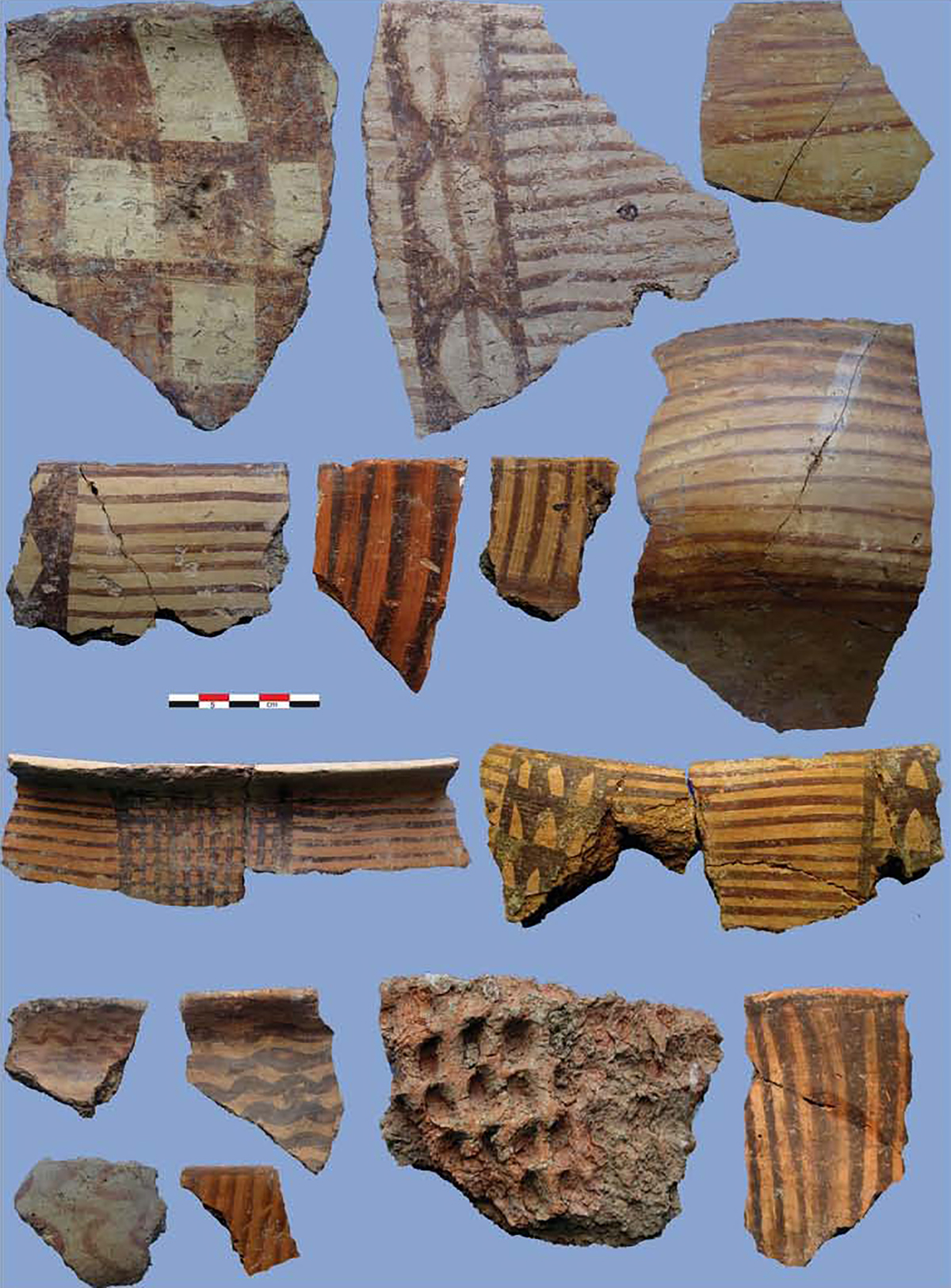
Tepe Sornā is located in the northern vicinity of the village of Kōpān and is only 4 km south of the rock-cut tomb known as Dau-Dokhtar. Tepe Sornā is a roughly circular mound, 100 x 100 m with a height of 24 m above the surrounding area. The Sarab Siāh stream flows around the northern side of the mound. Tepe Sornā has a strategic point in that all the passes out of the valley of the Tang-e Shir River are visible from the top of the mound. Based on the surface pottery, Tepe Sūrenā has a long archaeological sequence from the Middle Susiana period (c. 5000 B.C.) to the Sasanian and Islamic periods.
Archaeological Exploration
In December 1881, Captain Henry Lake Well of the Royal Engineers visited the site and wrote:
The plain extends to the east, like an arm of the sea, the sluggish stream of the Ser-ab-i-siah draining this arm and falling into the main stream two mi from the ridge. The fords of the main river and that of the Ser-ab-i-siah easy; that of the latter is just above where a remarkable mound, evidently artificial, is now crowned by a ruined mosque. The mound is circular in shape, has 40 feet of steep scarp, and 70 feet diameter.
In December 1935, Sir Aurel Stein visited the region and recorded his impression of the mound as follows:
Our camp, placed at Kūpūn, the westernmost hamlet of Deh-i-na, was gained after crossing first the wide floodbed of the Tang-i-Shīr stream and then two fairly deep water-courses draining the eastern portion of the valley. From there I visited in the morning of December 5th the conspicuous high mound known as Tul-i-Sūrneh, rising among irrigated fields a couple of miles to the east of Kūpūn. The mound, which is close on 100 feet high, measures some 400 yards in circumference on the top, now occupied by a gendarmerie post. It commands a wide view over all parts of the tract and obviously marks a site occupied during prolonged periods. But only little of coarsely painted sherds could be picked up near the foot of the mound, while higher up on the slopes all ceramics fragments on the surface, like the traces of mortared walls, looked late.
In 2005, a joint team of archaeologists from Sydney University and the Iranian Center for Archaeological Research led by Dan Potts and Kourosh Roustaei re-visited the mound and recorded all the visible remains.
Bibliography
Potts, D. T. and K. Roustaei, The Mamasani Archaeological Project stage one: a report on the first two seasons of the ICAR-University of Sydney expedition to the Mamasani district, Fars province, Iran, 1st edition, Tehran, 2006.
Stein, A. Old Routes of Western Iran, London, 1940, pp. 47-48.
Wells, H. L., “Surveying Tours in Southern Persia,” Proceedings of the Royal Geographical Society and Monthly Record of Geography, Vol. 5, No. 3 (Mar., 1883), pp. 160-161.