Borghanبورقان
Location: Borghān is a village in the district of Farāhān, in central western Iran, Markazi Province.
34°25’46.9″N 49°39’39.5″E
Map
Historical Period
Sasanian, Islamic
History and description
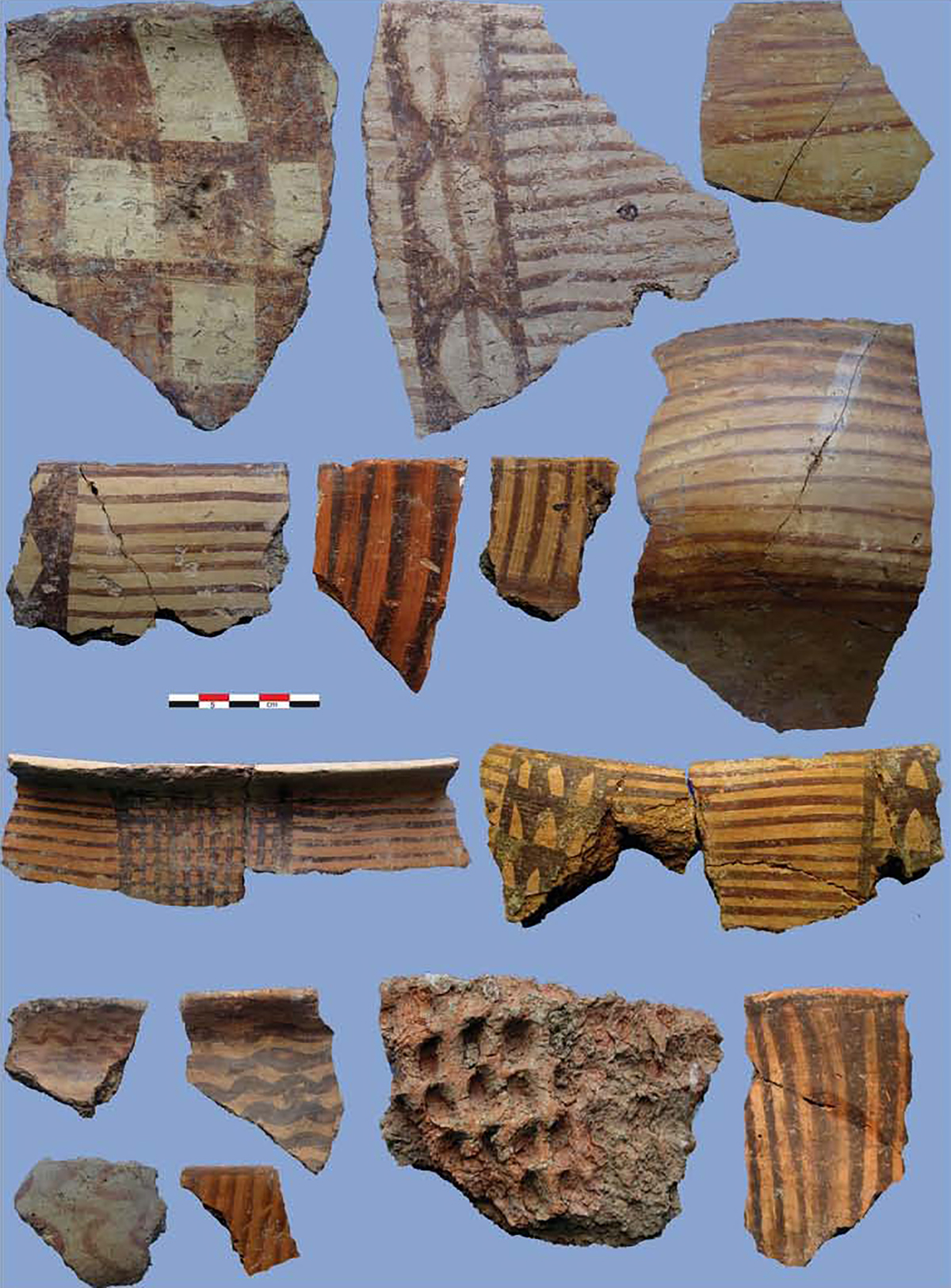
The village of Borghān lies 37 km north of Arak, and 10 km south of Farmahin, on the west side of the Arak-Farmahin road. In the village, there is a roughly oval, steep-sided mound known as Tepe Chal-e Ahmadi. The mound is 11 m high and covers an area of approximately half a hectare. Traces of potsherds (Clinky ware and Islamic lusterware) can be seen on the surface of the mound. According to Hasan Qomi, the tenth-century author of Tarikh-e Qom, Borghān was first built by Queen Pouran or Boran, daughter of Khosrow II, who briefly reigned in 631/32 A.D. He mentions that the place was in ruin in the tenth century (Tarikh-e Qom, pp. 56 and 78).
Archaeological Exploration
The mound was first recorded by David Stronach and Cuyler Young in their 1965 survey of the region.
Bibliography
Stronach, D. and T. C. Young, The 1965 Archaeological Survey of Western Iran, unpublished manuscript, the David Stronach Archive, BIPS.
Qomi, H., Tarikh-e Qom, Tehran, 1361/1982. In Persian